Drone Solution
Professionals who adapt drones into their mining operations quickly realize the significant added value they bring to their industry.
drones in mining improve the overall efficiency of large mine site and quarry management by providing accurate and comprehensive data detailing site conditions in a very short time. They also support better coordination among teams onsite and internationally, offering dynamic oversight of all operations.
APEX' drone solution provides a direct connection to aerial data and new levels of insight. This autonomous drone, streamlines operations, increases efficiency and offers immediate, easy access to the required data.
By use of high-resolution RGB cameras, professional hyperspectral and geophysical sensors, drones can identify types of minerals and geophysical anomalies early on. These valuable insights can reduce input costs and boost yield.
This technology provides critical information as below:
• Hyperspectral mineral mapping
• Stockpile Management
• Terrain mapping and change detection
• Asset management and scheduling
• Infrastructure and equipment inspection
• Security and surveillance
• Geotechnical Modeling
• Inspection & Monitoring
• Drilling & Blasting
• Hauling Optimization
• General Project Oversight
• Tailings Dams


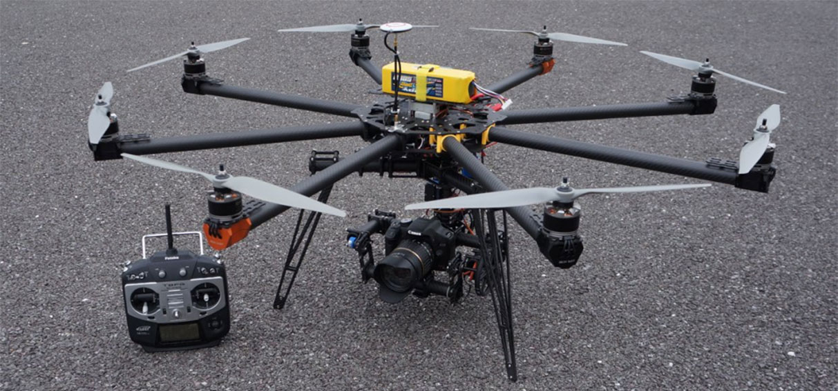
APEX’s Drones
APEX has purchased two advanced Drones for mineral exploration and mine mapping purpose:ITAL Drone BIGONE 8HSE
• Eight high efficiency brushless motors and carbon propellers
• 3-axes Gimbal for high stability capturing
• high-resolution 42mpx photogrammetric imaging (SONYA7-Rlll)
• Fast folding arms, carbon fiber frame for easy transport
• Standard equipment automatic safety parachute
• Redundant auto pilot provided with internal inertial platform, GPS, barometer, Data link equipped with RTH (return to home) with auto landing, auto take-off and position hold functions
• GPS Waypoints configuration for autonomous flight missions
• Flight planning software to perform “grid and survey” missions for georeferenced aerial photogrammetry
• Telemetric Data link for flight information and remote control
• Payload: 10 Kg
• Wind resistance13 m/s
• Max. range: 1,5 Km (LOS)
• Max. speed: 10 m/s

VERSA Drones HLO
• High performance octocopter• 2 operator control as standard
• Multiple high capacity Lithium Polymer battery packs give long flight times
• Assembled by hand to ensure each custom built UAV has complete reliability
• Airframe made from carbon fiber for a lightweight, strong, rigid structure
• Arms can easily be removed to minimise packed size and make transportation easier
• Payloads of up to 12kg
• 8 brushless motors and carbon fibre 15” rotors for maximum performance
• 3 axis brushless gimbal with independent control
• Live streaming of HD video
• GPS assisted flight with altitude hold, position hold and waypointing available
• Semi-automatic take-off and landing, and return to base failsafe
• Max speed: 70km
• Max altitude: 2km